
WINGS OVER CAMBRIDGE
CAMBRIDGE'S CONNECTIONS WITH THE WARTIME AIR FORCE -
Wartime
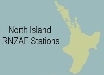
NORTH ISLAND
RNZAF Stations, Airfields and Depots
Below is a list of RNZAF stations, depots and facilities that were situated in the North Island of New Zealand. This is by no means complete yet, and in time more information will to be added to this. If any stations or depots, and their units, etc., have been missed, or you can make corrections and additions please
If you have any information about these stations, or the squadrons and units that served on them, I would be really pleased to hear from you.
(Note: This Page Is Constantly Being Added To)
North Island

Parengarenga Harbour
Class: Flying Boat Alighting Area?
Administered by: New Zealand Government
Closest Major Town or City: North Cape, Northland
History under RNZAF usage: At this stage the actual nature of this site is unknown to me. It is clearly one of the most northerly RNZAF sites and possibly a flying boat stopping point as it is a harbour. Alternately it may well have been an RNZAF Radar Station, or just an alternate name for the civil airstrip at Te Hapua, on the northern edge of the harbour
Opened as RNZAF Station: unknown
Closed as RNZAF Station: unknown
Today:
Wartime Units Permanently Stationed Here: unknown
Class: Civil Airfield
Administered by: New Zealand Government?
Closest Major Town or City: North Cape, Northland
History under RNZAF usage: This was a civil aerodrome or airfield on the northern edge of Parengarenga Harbour, which was designated on RNZAF flying maps for use in emergencies or perhaps for communications flights
Today: Unknown
Wartime Units Permanently Stationed Here: None known
Class: RNZAF Permanent Operational Flying Station
Administered by: Royal New Zealand Air Force
Closest Major Town or City: north of Kaitaia, Northland
History under RNZAF usage : Waipapakauri aerodrome was officially authorised for civilian aviation activities on the 29th of April 1935, being a landing field within the racecourse track. Over time the small strip was developed by No. 1 Aerodrome Construction Squadron into a fully equipped RNZAF Station. The station was completed by March 1941. By September 1943 the station also had a fully equipped anti-aircraft artillery unit on site, to defend the aerodrome from air attack.Situated north of Kaitaia in the very far north of New Zealand, this was a highly important station in both the defence of New Zealand and in the transit of RNZAF squadrons to and from the Pacific forward area. In 1940 with the threat of German raider ships in the Pacific and Tasman Sea, a detachment of a General Reconnaissance Squadron was rushed to Waipapakauri to patrol the waters and search for the enemy.
Historical Note: The first aerial seeding carried out in New Zealand was done at Waipapakauri in March 1941, carried out by the Public Works Department. Lupin seeds were sown onto the sand dunes in a reclamation effort.
Opened as RNZAF Station: August 1940
Closed as RNZAF Station: ?
RNZAF Waipapakauri Today: ?
Wartime Units Permanently Stationed Here:No. 1 Aerodrome Construction Squadron
No. 1 (General Reconnaissance) Squadron Detachment
Detached from No. 1 (GR) Squadron at Whenuapai, this was a Flight of Vickers Vincents, based at Waipapakauri's old racecourse which was converted into an aerodrome. The Grandstand was adapted to become a hangar so indoor maintenance could be achieved. Other racecourse buildings became the Mess, living quarters, etc. The local pub became at first the Officer's Mess, then the Base Hospital as the war progressed.The Detached Flight was originally sent to Waipapakauri in August 1940, as a strength of just three Vincents from ohakea, and their crews and staff from No. 1 Squadron at Whenuapai. This was in response to the German Raider ship In August the Orion, which sank the NZ ship Turakina some 400 miles west of Cape Egmont. Patrols to try to find the Orion were mounted from Ohakea's Air Gunner's and Air Observer's School, and from Auckland by the TEAL Short Empire flying boats. The Vincents operated from Waipapakauri attempting to locate the Orion for some days, butthe raider escaped without being attacked.
The detachment developed into Flight strength, and they covered the northern approaches to New Zealand, carrying out escorts and anti-shipping and anti-submarine patrols. The personnel of No. 1 Sqn Detachment rotated around as the main squadrons' A and B flights did alternate stints up north. Eventually the detachment was developed into a full stand alone squadron at the station, this being renamed No. 7 (GR) Sqn.
No. 7 (General Reconnaissance) Squadron
A full reconnaissance squadron was developed in February 1942 from the Flight of No. 1 (GR) Sqn that had been detached at Waipapakauri since1940. It was lead initially by Squadron Leader A. J. Turner, as C.O. from February 1942 till December 1942. he was then replaced by Squadron Leader Ron A. Kirkup who commanded the squadron from December 1942 till its disbandment in May 1943. The squadron used the same aircraft and personnel as had been used by No. 1 (GR) Squadron Detached Flight, but they were augmented with more men and Vickers biplanes. The squadron now had a strength of 12 + 6 Vincents. This meant twelve for daily ops, and six in reserve. They flew the Vincents on patrols ofNorthland and the northern approaches, carrying on the vital work that the Detached Flight had begun. No. 7 (GR) Sqn was disbanded in May 1943, and was never reformed in any form.Anti-Aircraft Unit
An anti-aircraft unit was established on the station to protect it from air attack. It was fully operational by September 1943, perhaps earlier.New Zealand Army Fortress Troops
Immediately after Japan's entry into the war, 120 New Zealand Army troops were sent to RNZAF Station Waipapakauri to defend the airfield from coastal attack. These were later joined by mobilised Territorials. In 1942 some were given the option of switching to the RNZAF and many took up that offer.
RNZAF Waipapakauri Links:
http://www.northnz.co.nz/news.htm
(Scan down the page a bit to 2 September 2004)
http://www.northnz.co.nz/November%202003.html
(Scan down the page a bit to 13 November 2003)
RNZAF Station Kaitaia
Class: RNZAF Landing Ground?
Administered by: Royal New Zealand Air Force
Closest Major Town or City: Kaitaia, Northland
History under RNZAF usage: This airfield was built by the Public Works Department for the RNZAF in 1942. The site had been selected by Flying Officer Arthur Bradshaw, who was an officer with the Aerodrome Services Branch of Air Headquarters.RNZAF Station Kaitaia became home to some members of No. 1 General Reconnaissance Squadron Detachment, who had been sent there from Waipapakauri. So this Flight was a Detachment of a Detachment.
Opened as RNZAF Station: 1942?
Closed as RNZAF Station: unknown
Today:
Wartime Units Permanently Stationed Here:No. 1 General Reconnaissance Squadron Detachment
Kerikeri
Class: PWD Landing Ground
Administered by: New Zealand Public Works Department
Closest Major Town or City: Kerikeri, Northland
History under RNZAF usage: Already a landing ground before the war, Kerikeri was apparently taken over by the RNZAF in 1939.
Opened as RNZAF Station: 1939
Closed as RNZAF Station: unknown
Today:
Wartime Units Permanently Stationed Here: unknown
Class: RNZAF Satellite Station
Administered by: Royal New Zealand Air Force
Closest Major Town or City: Dargaville, Northland
History under RNZAF usage: Despite this aerodrome being little known about, dues to its remoteness, secrecy and lack of operational usage during the war, we are very fortunate that historian Alan Britton, who lives in the Te Kopuru area, has kindly supplied a lot of information about the RNZAF Station at Te Kopuru.Apparently the idea of an airfield in the district of Te Kopuru was fist floated in 1935 when this message was sent from the Public Works Department engineer to Mr C. Franson.
24/01/1935.
Eng I/C to C Franson, Te Kopuru.
Herewith enclosed please find a pamphlet giving particulars of the area required for an aerodrome. I should say that a Class 'D' ground would be satisfactory for Te Kopuru.Alan says the area with which the engineers then were looking at for an airfield, north of Te Kopuru Village according to the accompanying map, is not the same site as where the airstrip was later in 1942 established for RNZAF use. Alan has also supplied the following wartime correspondence relating to the airfield, which makes very interesting reading. The notes in brackets are by Alan Britton I believe)
09/07/1942
Eng I/C to AirlSec.
Suggested Aerodrome Ruawai.The site was inspected at Ruawai but was a low lying mud-flat area. The land is below the high spring tide level and in normal wet weather there is about 6'1 of freeboard and from the military point of view damage to the automatic drainage gates would flood large tracts of country and this site is not considered suitable. Other sites were inspected and the only promising one was on the western side of the Wairoa River about one mile south of Te Kopuru.
At this point the soils are of an entirely different character to others in the District and are suitable for a turf aerodrome. Surface conditions are almost satisfactory in the natural state, time did not permit a thorough investigation but if desired a preliminary report can be submitted for this area.(There is a map following this letter which shows the area around the site selected on the west bank of the river ghb). PWD 23/381/73, Part 1
14/07/1942
Eng I/C to CAS.
Suggested Aerodrome Ruawai.It was inspected by Mr Langbein, Highways Engineer accompanied by Lt Commander H H Houk of US Forces. They inspected various sites on the ?? and also on the Te Kopuru side.
The major difficulties with the Ruawai side were the extreme levelness of all suitable land, low margins between high water, spring tide level and surface level of all sites, unstable soil and liability of fog. The site on the Te Kopuru side would require investigation as to level and possibility of satisfactory layout before it would be possible to compare it with other sites.
If a decision is made to construct an aerodrome in the locality it would be necessary to build up the runways with stable material, which is apparently available within reasonable range, to a depth of from 12" to 18".
The construction of an aerodrome in the locality is a summertime job and should, on no account, be attempted under winter conditions. PWD 23/381/73, Part 1.
18/08/1942.
Eng I/C to Air/Sec.
Enclosed preliminary report on proposed aerodrome site on Te Kopuru Flats.
You will see a full strip development is possible up to 7000' in length and from an analysis of the penetration test carried out on the Ruawai and Te Kopuru Flats it is obvious that the Te Kopuru preferable. Construction will take about four months to complete two stabilised strips.
Work would commence about the beginning of November, the estimated costs, including purchase of land, laying of strips and clearing of obstructions is £45,000.
The property is Tokatoka SD, Part DP 25146, Block 5, Part Section 15, 16, 17, 19 & 20 and is .situated between the west bank of the Northern Wairoa River and the Dargaville - Tikinui Highway on flats, one mile south of Te Kopuru. PWD 23/381/73, Part 1.
20/08/1942
A H Neville to Min of Defence. As you are aware a new aerodrome is under construction at Kaitaia which it is proposed to use as a fighter station for the defence of the vital area of the Bay of Islands. An
extension has been made to the landing ground at Waipapakauri to enable this aerodrome to be used by modern types of aircraft.
Owing to the nature of the soil in winter conditions there is little chance that these aerodromes will be available for use before the end of next summer.
The North Auckland Province is not generally suitable for the construction of aerodromes. Other than Kaitaia and Waipapakauri, which are under construction, there are no aerodromes suitable for the operation of modern service types until Whenuapai is reached which is 150 miles further south.
The two small aerodromes at Kerikeri and Whangarei are incapable of extension and cannot be used for modern service types.
The lack of any suitable aerodrome south of the Bay of Islands Fortress Area constitutes a serious disability to the general defence schemes in the North Auckland Province. Moreover the lack of any aerodrome north of Auckland for Hudsons involves greatly increased flying hours for reconnaissance aircraft which could otherwise be avoided.
Surveys have been carried out for some time with the object of finding a suitable site in the Dargaville area and the sites at Ruawai and Te Kopuru have both received detailed examination.
The latter site, one mile south of Te Kopuru, is in all respects suitable for the development of a modern aerodrome and could be brought into use at a relatively small expense within six weeks or two months for use by Hudsons and similar types during summer conditions.
While this landing ground fills a vital gap in the distribution of operational aerodromes in the North Auckland Province it is not proposed to develop an Air Force Station on this site until the necessity becomes more apparent and the number of aircraft available justify such action.
It is proposed however in the meantime, to use this aerodrome as an advanced landing ground for reconnaissance aircraft of the Hudson type which will involve a limited amount of stabilisation of the runways and a minimum of operational facilities.
It is proposed that the area required should be leased from the farmers, rather than purchased, and the ground taken over by the Air Force is limited to the minimum required for runways.
One important advantage of this proposal is the provision of a suitable aerodrome in the North Auckland Province from which modern types could operate this summer pending the construction of the more advanced aerodromes at Kaitaia and Waipapakauri.
The cost of preparing the landing ground, exclusive of the cost of leasing the land, is estimated at £7,000. It was recommended that he obtain approval from War Cabinet. PWD 23/381/73, Part 1.
20/08/1942
DCAS to Eng I/C.
Contents of this letter follow the same general
lines as the one of the same date from Neville to Min of Defence Re the development of suitable runways satisfactory for the operation of Hudsons or similar types, he goes on little earth works involved do not appear to be heavy and it is possible the project could be most suitably be carried out
by No 1 Aerodrome Construction Unit. PWD 23/381/73, Part 1.
29/09/1942
AMS to DC NG. Te Kopuru.
The policy to be followed in connection with the provision of a landing ground at Te Kopuru has been given further consideration by Air Staff and a ruling has been given as follows: "The construction of a temporary strip landing ground as recommended by the AOCNG is approved. It was decided that work should be commenced as soon as possible, preferably by No 1 Aerodrome Construction Unit.
The question of making a permanent aerodrome at Te Kopuru, or at any other site in this vicinity, should not be considered until Kaitaia is finished."
Would you please arrange for the Area Engineer to take the necessary action to provide this temporary landing strip, to your requirements, as soon as possible. (In this file is Drawing WR 5494, Te Kopuru Aerodrome). PWD 23/381/73, Part 1.
03/10/1942
AOCNG to OC No 1 Construction Unit, Rukuhia.
Instructions received from Air HQ that your Unit is to proceed with the construction of a temporary field, as per our Scheme No 2 Te Kopuru.
This HQ is of the opinion that this work is of no value unless completed by the end of November and it is hoped that you will be able to allocate a Section to proceed forthwith with the work of clearing and culverting.
The following arrangements have been made;
1. Air HQ asked to instruct the Eng I/C re taking of land.
2. DIE asked to provide 12 PWD tents.
3. D/E asked to provide temporary cook-house facilities.
4. One 36'xl0' tropical type hut has been forwarded by rail for use as a
dining room/recreation room. Trucks will be obtainable on hire should
service vehicles not be available. PWD 23/381/73, Part 1.
16/10/1942
DOW (Air) to Eng l/C. Advised that the Min of Defence had approved work in connection with the Te Kopuru aerodrome and for him to proceed. PWD 23/381/73, Part 1.
22/10/1942
Copy, AOCNG to Air HQ. Enclosed plans showing proposed runways and drainage. Action taken so far;
1. Survey made by Construction Sqdn estimates submitted.
2. PWD instructed by you on 30 Sept to arrange lease of land.
3. PWD asked to provide camp of 12 PWD tents and temporary cook-house.
4. Official authority received on 16 October.
5. Plans showing runways submitted to District Engineer CD/E).
6. A slightly revised layout of runway system prepared in this HQ
in order to reduce the drainage problems.
Arrangements have been made for No 1 Construction Unit to send a Section to Te Kopuru but before this can take effect it is necessary to confirm what arrangements the DIE has been able to make towards camp" accommodation, whether a drag-line shovel can be allocated from the District and to arrange for the supply of six Air Force trucks to No 1 Construction Sqdn. This last has not been pressing pending completion of arrangements for Waipapakauri but should you be in a position to allocate a further six trucks to No 1 Const Unit, these should be sent to Dargaville. PWD 23/381/73, Part 1.
22/10/1942
AOCNG to Air HQ. Relates in the main to laying of drains etc and the costs. There was also some problem in obtaining the dragline. PWD 23/381/71, Part 1.22/12/1942
Asst Und/Sec to J G Coates, Wgton. Regarding Te Kopuru, he has ascertained what the definite proposals of the Air Force are.
The Air Force No 1 Const Unit will construct two runways, put them in pasture grass then restore the fences to their original positions. The Air Force will then have the runways available should their use be required in"an emergency.
In the meantime the farms concerned will not be disturbed apart from the disturbance consequent upon the grading of the runways. The Air Force hopes to have the whole of the work done and be out of the place by the end of January. (1943). PWD 23/381/73, Part 1.
27/05/1943
D/E to Perm Head. Advising that the flying field at Te Kopuru is available for use as regards to the conditions of surface etc. The original boundary fences across the runways have been replaced with electric fences as these can be easily removed if the field is to be used. Enclosed were two copies of the plan for Air Pilot information as received in Wellington on 31 May 1943. Information in the letter placed the field on the eastern side of the Dargaville-Tikinui main road, approx 1.5 miles south/east of Te Kopuru Village and between the main road and the Wairoa River. The airfield being 4' above sea level. East of the airfield and on the opposite bank of the river if the settlement of Tokatoka. (The enclosed plan is too large to go an one sheet of A4 but could go on perhaps two or be reduced to A4 ghb **).The airfield is under the control of the PWD. Surface Conditions, Good grass surface, reasonable hard with usual obstructions, Phone Lines, electric fences crossing runways.
Refueling, available from Whangarei.
Repair and hangar facilities, Nil.
Transport, Daily services from Te Kopuru to Dargaville.
Accommodation, Aratapu Hotel - 3.25 miles.
Radio, Nil.
Weather Conditions, Available from the North Auckland Times Office, Dargaville. PWD 23/381/121.
30/06/1943
Inspection Report By F E T Suckling DSIR.
Te Kopuru was inspected and the work required to be done;
The general condition of the turf, grass has established fairly well on the runways and is spreading well to fill up the gaps. Paspallum is recovering quickly, stock grazing on the area are causing damage by pugging and making tracks.
Work required to be done; Grass has made a good strike over most of the field and is still making some growth. Large areas are water logged and may cause some new grass to die off. Heavy grazing has been the practice of the farmers on the runways and this is causing poaching and other damage before grass is properly established. Tracks across the runways are common showing that the farmers are not making their stock use the metal races provided. There appears to be no definite policy regarding this field. It was our recommendation that no grazing should be done until that grass had properly established. This recommendation was obviously not adhered to. PWD 23/381/73, Part 1.
/ /1943
Air Pilot Information.
There is a tracing for the Air Pilot at the end of the file, which I will get photocopied (25/6/90).
The Te Kopuru Aerodrome Information is as follows :
Latitude: 0 Longitude: 0
Magnetic Variation: 15 deg East approx.
Telegrams: None.
Telephone: Post Office, Te Kopuru, 1.25 miles from aerodrome. Telephone in Private House 0.5 Mile, Mr C. Moore, Phone 26D Te Kopuru. Controlling Authority: PWD.
Landing Area:
(A) Dimensions N/W - S/E, 1738 yards. S/W - N/E, 1628 yards.
(B) Altitude above Mean Sea Level. 4 ft approximately.
(C) Surface Conditions. Good grass surface, reasonably hard.
(D) Obstructions requiring special precaution. Light electric fences, metal
crossings. Telephone line along main road.
(E) Special Signals. None.This was apparently built by the Public Works Department for the RNZAF during the war, as an emergency fighter airstrip. RNZAF Station Te Kopuru was apparently on the opposite side of the Northern Wairoa River (an arm of the Kaipara Harbour) from the current Dargaville Airport. The latter was constructed postwar. Te Kopuru is south west of the town of Dargaville, towards Poutu, the North Kaipara head.
The land is mainly sandy, with the dunes backing towards Baileys Beach. The flat area around Te Kopuru was drained quite early in the area's history and made a suitable emergency landing area.
Opened as RNZAF Station: 27th of May 1943
Closed as RNZAF Station: unknown
Today:
Wartime Units Permanently Stationed Here: unknownThanks to Sean Strang and Bruce Cooke for their assistance on this information
Link To Another Site: http://www.te-kopuru.co.nz/The_RNZAF_Airfield.cfm
Bay of Islands (Russell)
Class: NZ Government Landing Ground
Administered by: New Zealand Government
Closest Major Town or City: Russell, Northland
History under RNZAF usage: unknown
Opened as RNZAF Station: unknown
Closed as RNZAF Station: unknown
Today:
Wartime Units Permanently Stationed Here: unknown
Kaikohe
Class: RNZAF Landing Ground
Administered by: Royal New Zealand Air Force
Closest Major Town or City: Kaikohe, Northland
History under RNZAF usage: Kaikohe aerodrome was officially authorised for civilian aviation activities on the 14th of October 1935. This was a civil aerodrome or airfield, which was designated on RNZAF flying maps for use in emergencies or perhaps for communications flights. It probably had operational flights also made by the General Reconaissance Squadrons based permanently at Waipapakauri
Opened as RNZAF Station: unknown
Closed as RNZAF Station: unknown
Today:
Wartime Units Permanently Stationed Here: unknown
RNZAF Station Whangarei
Class: RNZAF Landing Ground?
Administered by: Royal New Zealand Air Force
Closest Major Town or City: Whangarei, Northland
History under RNZAF usage: Whangarei aerodrome was officially authorised for civilian aviation activities on the 7th of November 1934
Opened as RNZAF Station: unknown
Closed as RNZAF Station: unknown
Today:
Wartime Units Permanently Stationed Here: unknown
RNZAF Station Onerahi
Class: RNZAF Landing Ground, semi-operational
Administered by: Royal New Zealand Air Force
Closest Major Town or City: just south of Whangarei, Northland
History under RNZAF usage: This station was on the foreshore
Opened as RNZAF Station: unknown
Closed as RNZAF Station: unknown
Wartime Station Commanders:
Flight Lieutenant "Lou" Gates (RAF)Today:
Wartime Units Permanently Stationed Here:No 20 (Army Co-operation) Squadron
Formed at RNZAF Station Onerahi in August 1942 with Hawker Hind biplanes under acting Wing Commander J.G. Fraser RAF
Claris, Great Barrier Island
Class: PWD Landing Ground
Administered by: New Zealand Public Works Department
Closest Major Town or City: East of Port Fitzroy, Great Barrier Island
History under RNZAF usage: Grant Wilson has emailed to say that this airstrip on Great Barrier Island was used by No. 1 (Auckland) Squadron just after the outbreak of war. Apparently a flight of Vincents was based there for a period to assist in the defence of the Auckland region. A wartime airman himself, though not involved, Grant says he flew there often postwar for the Auckland Aeroclub and was often weatherd in at the strip. He would have his aircraft picketed in the same place where the Vincents once stood. He writes," All together there were 9 tie down points. {3 sets} The locals explained that the Air Force had set these in the ground for the Vincent's."Grant also wrote, " I know at least one Hudson landed and safely made a take off from that very short strip." So this indicates the RNZAF was still using the strip into 1941 at least, and maybe later.
Opened as RNZAF Station: Late 1939
Closed as RNZAF Station: unknown
Today: The airfield is still in use today, and has a sealed runway
Wartime Units Permanently Stationed Here:No. 1 (Auckland) Squadron Detachment
Flying around three Vickers Vincents in defence of the northern approaches to Auckland harbour
For the greater Auckland region, click here
For the Waikato and Bay of Plenty regions, click here
Central North Island Region
Map Coming Soon
Atiamuri
Class: PWD Landing Ground
Administered by: New Zealand Public Works Department
Closest Major Town or City: Kinleith, Bay of Plenty
History under RNZAF usage: This was a civil aerodrome or airfield, which was designated on RNZAF flying maps for use in emergencies or perhaps for communications flights
Today:
Wartime Units Permanently Stationed Here:
Galatea
Class: NZ Government Landing Ground
Administered by: New Zealand Government
Closest Major Town or City: Murupara, South Waikato
History under RNZAF usage: This was a civil aerodrome or airfield, which was designated on RNZAF flying maps for use in emergencies or perhaps for communications flights
Today:
Wartime Units Permanently Stationed Here:
Te Kuiti
Class: Civil Aero Club Landing Ground
Administered by: Te Kuiti Aero Club
Closest Major Town or City: Te Kuiti
History under RNZAF usage: This was a civil aerodrome or airfield, which was designated on RNZAF flying maps for use in emergencies or perhaps for communications flights
Today:
Wartime Units Permanently Stationed Here:
Karioi
Class: PWD Landing Ground
Administered by: New Zealand Public Works Department
Closest Major Town or City: Ohakune, Mt Ruapehu
History under RNZAF usage: This was a civil aerodrome or airfield, which was designated on RNZAF flying maps for use in emergencies or perhaps for communications flights
Today:
Wartime Units Permanently Stationed Here:
North Island's Western Approaches
Map Coming Soon
RNZAF Station New Plymouth
(aka RNZAF Station Bell Block)
Class: RNZAF Permanent Flying Training and Operational Training Station
Administered by: Royal New Zealand Air Force
Closest Major Town or City: Bell Block, New Plymouth
History under RNZAF usage: An ex-municipal aerodrome, officially operating since the 6th of July 1935, Bell Block became a hugely important RNZAF station at the immediate outbreak of war in 1939. The Public Works Department moved in, beginning work to transform the airfield into a station on the 9th of September 1939. All was complete for the RNZAF to take over in October 1939.No 2 Elementary Flying Training School was set up on the station in 1939 using impressed de Havilland DH82 Tiger Moths, DH60 Moths and other light trainers that had been sourced from many aeroclubs around the country. Later in the war No 2EFTS moved to Ashburton, but Bell Block became the home of the School of General Reconnaissance, where its modern Avro Ansons were used to train pilots, navigators and gunners who would move on to the GR squadrons flying Hudsons, and later Venturas in the Pacific.
Opened as RNZAF Station: 25th of September 1939
Closed as RNZAF Station: 30th of September 1945. The airfield was returned to the New Plymouth Aero Club.
Wartime Station Commanders:
Squadron Leader Arthur Cole Upham, DFC - was Station Commander from mid-October 1939 till at least April 1941, not sure how long for after that date
Today: I assume today it is still an Aero Club airfield. Can anyone confirm this please?
Wartime Units Permanently Stationed Here:No 2 Elementary Flying Training School
Flying DH60 Moths and other assorted light trainers such as Miles Hawk and Magister types. Later DH82 Tiger Moths joined the school, which moved to RNZAF Station Ashburton in September 1942School of General Reconnaissance
( flying Avro Ansons, having moved to Bell Block from Omaka)No. 1 Operational Training Unit, RNZAF Station Bell Block
(flying Lockheed Hudsons, Airspeed Oxfords, Vickers Vincents, North American Harvards, and later Lockheed Venturas). This unit moved to Bell Block from RNZAF Station Levin in October 1942. However after a brief period it was found the Hudsons were too heavy for the Bell Block runway and the unit moved to OhakeaGround Training Schools
This station also had a number of ground training schools for airmen and officers. I have not found out the specific titles of these schools, but they were specialist in nature, one being for officer straining for skilled entrants - those coming into the RNZAF already trained as lawyers, accountants or teachers.
Hawera
Class: Civil Aero Club Landing Ground
Administered by: Hawera Aero Club
Closest Major Town or City: Hawera
History under RNZAF usage: Hawera aerodrome was officially authorised for civilian aviation activities on the 13th of March 1934. The aerodrome had previously seen aviation activities however, including as far back as 1928 when the Southern Cross landed at Hawera on its way up to and back from Auckland.This was a civil aerodrome or airfield, which was designated on RNZAF flying maps for use in emergencies or perhaps for communications flights
Today:
Wartime Units Permanently Stationed Here: None known
Stratford
Class: Council Landing Ground
Administered by: Stratford Council
Closest Major Town or City: Stratford
History under RNZAF usage: Stratford aerodrome was officially authorised for civilian aviation activities on the 29th of March 1935. This was a civil aerodrome or airfield, which was designated on RNZAF flying maps for use in emergencies or perhaps for communications flights
Today:
Wartime Units Permanently Stationed Here: None known
Lower North Island Regions
Map Coming Soon
RNZAF Station Linton
Class: RNZAF Ground Training Station
Administered by: Royal New Zealand Air Force
Closest Major Town or City: Palmerston North
History under RNZAF usage: Linton Camp had long been a military establishment before it became an RNZAF Station. The RNZAF had used it prewar for intakes of new recruits as far back as 1936, but at that time it was still under New Zealand Army control as a camp. However for a brief period between April and November 1943 the camp came under the administration of the RNZAF, and was designated as an RNZAF Station. It became home to ground training units during this period. Also some airmen who were rotating back to New Zealand from the Pacific theatre were rested at Linton, including Cliff Morriss of Cambridge. Following November 1943 the camp reverted to Army ownership. In recent years all three services have been based at Linton.
Opened as RNZAF Station: April 1943
Closed as RNZAF Station: November 1943
Today: Linton is now a joint forces base, home to personnel from the New Zealand Army, Royal New Zealand Navy and the Royal New Zealand Air Force
Wartime Units Permanently Stationed Here:No. 3 Ground Training Depot
Formed at Linton in April 1943, No. 3 GTD operated until November that year. During this time intakes of new recruits were taken into the RNZAF at Linton for initial trainingRNZAF Cookery School
According to "The Royal New Zealand Air Force" by J.M.S. Ross, an RNZAF cookery school was established at Linton for several months during the period that Linton was under RNZAF command.
RNZAF Station Ohakea
Class: RNZAF Permanent Operational and Flying Training Station
Administered by: Royal New Zealand Air Force
Closest Major Town or City: Bulls, Manawatu (north of Palmerston North)
History under RNZAF usage: RNZAF Station Ohakea was initially designed to become an operational bomber base, and was first commissioned in 1937 when the RNZAF ordered 30 new Vickers Wellington bombers to modernise its capabilities. The intention was to create two new bomber squadrons, one at Ohakea and the other at Whenuapai, another new station built at the same time to basically the same design.However when war looked imminent in Europe, the New Zealand Government offered the Wellington to Britain's RAF, and they went on to form the New Zealand Bomber Flight. This became No. 75 Squadron, which would postwar be associate with Ohakea from 1947 till 2001. But that's another story.
So when war came to New Zealand, Ohakea actually became a training base for the early part of the war. Eventually operational squadrons did become part of the station, No. 2 (BR) Squadron for one. And eventually three Operational Training Units were based there, as well as No. 3 Service Flying training School, the Air Gunners and Air Observers School, and many other training schools and units at various times.
Opened as RNZAF Station: 18th of September 1939
Wartime Station Commanders:
Wing Commander E.G. Gedge - from Station's opening day on 18th of September 1939 till ?
Wing Commander F.E.T. Hewlett D.S.O., O.B.E. - was Station Commander approx July 1940 till July 1941
WGCDR Alfred John Turner OBE Station Commander June till December 1945
AVM Malcolm Frederick Calder dates unknown
Today: Ohakea remains an active RNZAF base
Wartime Units Permanently Stationed Here:No. 1 Air Observers School
Flying de Havilland DH86 Express ex-airliners, later known as Air Gunners and Air Observers SchoolNo. 1 (Bomber) Operational Training Unit
Flying Hudson bombers, This OTU later moved to RNZAF Station Levin in mid to late 1942No. 2 (Fighter) Operational Training Unit
Flying P40 KittyhawksNo. 2 (Bomber Reconnaissance) Squadron
Flying Lockheed Venturas, working up to operational level before deployment to the PacificNo. 3 Service Flying Training School, (Initial Training Squadron)
Flying Hawker HindsNo. 3 Service Flying Training School, (Advanced Training Squadron)
Flying Hawker HindsNo. 4 (Fighter) Operational Training Unit
Flying P40 Kittyhawks. Newly trained pilots converted onto P40 Kittyhawks and Warhawks of all marks here. This school moved to Ohakea in 1944 with the arrival of the Corsairs at its previous base at RNZAF Station ArdmoreNo. 10 (GR) Squadron
Flying Hudson bombers for a very short few weeks before the unit transformed into No. 10 OTUNo. 10 Bomber Operational Training Unit
Flying Hudson bombersNo. 11 Operational Training Unit (OTU)
Unit 19
A maintenance unit
RNZAF Station Levin (Wereroa)
Class: RNZAF Ground Training Station with a Landing Ground
Administered by: Royal New Zealand Air Force
Closest Major Town or City: Levin
History under RNZAF usage: An ex-municipal aerodrome which had officially gained authorisation to operate as an airfield on the 11th of July 1935, Levin became an RNZAF Station just after the immediate outbreak of war in 1939. The Government Training Farm at Weraroa had been taken over by the RNZAF for the purpose of training new recruits, and the Initial Training School was transferred into Levin from RNZAF Station Rongotai in October 1939. This later became known as the Initial Training Wing.Most airmen and many WAAFs who joined the RNZAF during the first half of the war passed through RNZAF Levin, because this was the home of the Initial Training Wing from 1939 till 1942. Airmen knew the place by both names of Levin and Wereroa, which can be confusing for some. This was where raw recruits learned the basics of service life and were turned into airmen and airwomen before moving onto more specific trade training. The station also had the airfield which saw some activity during the war. When ITW moved on, the Bomber Operational Training Unit that had previously been at Ohakea moved in.
Opened as RNZAF Station: October 1939
Closed as RNZAF Station: 19??
Wartime Station Commanders:
Wing Commander Ronald James Sinclair - ? till approx Jan 1942 (posted to command RNZAF Station Taieri)
Air Commodore Trevor Watts White CBE, ED - must have been CO from January 1942 till March 1942
Wing Commander FR Dix March 1942 - ? 1943
Wing Commander Arthur Colwell Upham DFC - Dates unknown
Today:
Wartime Units Permanently Stationed Here:Initial Training Wing
Originally entitled Initial Training School, this was the main entry point that most airmen were sent to where basic military training and Air Force life was instilled into new recruits. It was based at Levin from 1939 through till February 1942, when it was shifted up to Rotorua. The first course of airmen pilots, observers, and air-gunners to pass through Levin started training there on the 20th of October 1939No. 1 (Bomber) Operational Training Unit
This unit had previously been stationed at RNZAF Ohakea, and it trained pilots to fly the RNZAF reconnaissance bombers on HudsonsNo. 10 (Bomber) Operational Training Unit
This unit had previously been stationed at RNZAF Ohakea, and it trained pilots to fly the RNZAF reconnaissance bombers on HudsonsOfficers' School of Instruction
This moved back from Omaka to Levin when the South Island base had closed down in April 1944 when sufficient accommodation had become availableContact
From the magazine's inception in 1941 till January/February 1942 when the office moved to RNZAF Rotorua. See here
RNZAF Station Fielding
Class: RNZAF Landing Ground
Administered by: Royal New Zealand Air Force
Closest Major Town or City: Fielding
History under RNZAF usage: Fielding's aerodrome was in use with civilian aviation activities since May 1935. This was a civil aerodrome or airfield, which was designated on RNZAF flying maps for use in emergencies or perhaps for communications flights. Though not yet confirmed this airfield may also have been used as a satellite aerodrome for the training schools at nearby RNZAF Station Ohakea
Today:
Wartime Units Permanently Stationed Here: None Known
RNZAF Station Milson / RNZAF Station Palmerston North
Class: RNZAF Landing Ground
Administered by: Royal New Zealand Air Force
Closest Major Town or City: Palmerston North
History under RNZAF usage: This was Milson Aerodrome, which had been operating as an airport since 1935, but had previously been an airstrip since the 5th of December 1931. In 1933 Sir Charles Kingsford Smith landed the Southern Cross there. On that occasion the strip had been enlarged by taking fences out of a farm paddock. Unfortunately a dividing drain had only been partially filled and the Southern Cross had a taxiing accident when its wheel sank into the drain, and it struck the port wing on the ground, damaging it and the port propeller. The aircraft was soon mended.The Manawatu Aero Club activity which had previously flourished at Milson, ceased in late 1939 when the RNZAF requisitioned most of the aircraft for impressment. However the station continued being the main base for Union Airways throughout the war, and as well as maintenance on their own fleet, Union Airways also carried out overhauls and rebuilds of several Air Department aircraft too. More interestingly, they did all the major overhauls of the RNZAF's fleet of Hawker Hinds.
In January 1943 the station was renamed as RNZAF Station Palmerston North. In August 1943 the aerial use of the station was disbanded, and only ground radio and radar units remained at the areodrome. These were gone by January 1944.
However Brendon Deere's book Military Wings Volume 2 says that four or five Tiger Moths of the Air Training Corps Touring Flight were based at Palmerston North from May 1943 till VJ day. This flight must have moved there from RNZAF Station Rongotai.
Opened as RNZAF Station: March 1942
Closed as RNZAF Station: January 1944
Wartime Station Commanders:
Wing Commander J.G. Fraser (CO of No. 6 (AC) Sqn from March 1942 - ?)
Squadron Leader Sidney Wiltshire GC (up till approx March 1943)Today: Today Milson is Palmerston North Airport, and is used by internal commuter airliners. Some budget trans-Tasman airline services also fly from Palmerston North Airport.
Wartime Units Permanently Stationed Here:No. 6 (Army Co-operation) Squadron
Operating Hawker Hinds from MArch 1942 till November 1942. The squadron's main purpose was ground support exercises with units of the New Zealand Army, as well as units from the US Marine Corps who were stationed at Paekakariki.In May 1942 No. 6 Sqn Hinds took part in a major exercise called "The Battle of the Milson Line" co-operating with No. 2 Brigade. In the following July two flights of six Hinds used air support for the first time in New Zealand when they attacked ground targets on Mount Stewart. A detached Flight of No. 6 (AC) Squadron was situated at RNZAF Station Ohakea till November 1942
No. 21 (Army Co-operation) Squadron
In November 1942 the No. 6 (AC) Squadron Detached Flight at Ohakea returned to Milson and was developed into No. 21 (AC) Squadron. At this point they took over the Hinds of 6 (AC) Squadron, and what had been No. 6 Sqn at Milson was posted to Ohakea to become No. 22 (AC) Squadron. They re-equipped with Vincents and Vildebeests and continued in the army co-operation role.No. 21 (AC) Sqn continued to exercise wiith the army, and also train air liaison officers. The squadron began to re-equip with North American Harvards in May 1943. One such appears in the book "RNZAF: The First Decade" by Charles Darby, and features Pinnochio nose art.
The squadron trained personnel from the Second Marine Division, USMC in air observation in mid-1943. This included direct air support missions with the Marines and the 4th NZ Division during exercises in the Levin, Foxton, Paekakariki and Masterton areas.
During July 1943 the squadron began to be run down and it disbanded completely in August 1943.
Air Training Corps Touring Flight
Flying four or five Tiger MothsSource: One good source for information here about RNZAF Station Milson was the book Airways 1936-1986 - 50 Years by Ross Macpherson
RNZAF Milson/ RNZAF Palmerston North Links
RNZAF Station Kaitoke (Wanganui)
Class: RNZAF Landing Ground
Administered by: Royal New Zealand Air Force
Closest Major Town or City: Wanganui
History under RNZAF usage: Already a landing ground since officially being given authorization as such on the 20th of March 1935, Wanganui Aerodrome was apparently taken over by the RNZAF in 1939. However there were still civilian aviators operating from this aerodrome well into the war too. The reason they took it over is unknown to me, perhaps for emergency defence on the coast, or perhaps as a satellite or for communications. I don't think any air units were based there permanently. One source says the airfield was built for the RNZAF during the war by the Public Works Department, but this is more likely meaning a new runway was constructed for the RNZAF, as this was a long established airfield as mentioned.
Opened as RNZAF Station: 1939
Closed as RNZAF Station: 19??
Today: Apparently Kaitoke is still Wanganui's airport today
Wartime Units Permanently Stationed Here: None known
Dannevirke
Class: D.A.A. Landing Ground
Administered by: D.A.A
Closest Major Town or City: Dannevirke
History under RNZAF usage: Dannevirke aerodrome was officially authorised for civilian aviation activities on the 21st of September 1934. This was a civil aerodrome or airfield, which was designated on RNZAF flying maps for use in emergencies or perhaps for communications flights
Today:
Wartime Units Permanently Stationed Here:
RNZAF Station Masterton

Class: RNZAF Landing Ground and briefly an Operational Station
Administered by: Royal New Zealand Air Force
Closest Major Town or City: Masterton
History under RNZAF usage: This was and still is known as Hood Aerodrome, named after George Hood who died on the first ever attempt to fly across the Tasman Sea
Opened as RNZAF Station: 194
Closed as RNZAF Station: 194
Wartime Station Commanders:
Wing Commander John Ayling (RAF)
Today: Today Hood Aerodrome, Masterton remains the district's airport, and is also home to an important collection of vintage and wartime aircraft. The aerodrome is home of the New Zealand Sport and Vintage Aviation Society (see their website by clicking here) and also the Old Stick and Rudder Company - a private collection of aircraft that now includes the only flyable RNZAF Corsair in the world - formerly with the Old Flying Machine Company in Britain. If you wish to visit Hood Aerodrome (formerly RNZAF Station Masterton) click here to see the SVAS map showing how to get there.
Wartime Units Permanently Stationed Here:No 14 (Fighter) Squadron
The squadron, which was to become one of the RNZAF's most famous and gain the nickname 'The Fighting Fourteenth', moved to RNZAF Station Masterton in May 1942. When they arrived the squadron were still flying Harvards, but later they re-equiped with Curtiss P40E Kittyhawks. No. 14 Sqn was under the command of Sqn Ldr John N. Mackenzie while at Masterton, and also later when they moved into the forward area. The squadron had originally formed at Ohakea under Mackenzie in April 1942, made up from the survivors of the ill-fated 488 Sqn that had been defeated in the defense of Singapore and Malaya.208 Squadron, RNZAF Aerodrome Defence Unit
North Island's East Coast
Map Coming Soon
Napier
Class: PWD Landing Ground
Administered by: New Zealand Public Works Department
Closest Major Town or City: Napier
History under RNZAF usage: Known as Westshore aerodrome, it was officially authorised for civilian aviation activities on the 12th of August 1935. This was a civil aerodrome or airfield, which was designated on RNZAF flying maps for use in emergencies or perhaps for communications flights. I believe it was sometimes used for reuelling and overnighting by No. 8 General Reconnaissance Squadron aircraft from Gisborne when doing unusual patrols
Today:
Wartime Units Permanently Stationed Here:
Link: http://www.wings.net.nz/aeroclub.html
Hastings
Class: Aero Club Landing Ground
Administered by: Hawkes Bay & East Coast Aero Club
Closest Major Town or City: Bridge Pa, Hastings
History under RNZAF usage: This was a civil aerodrome or airfield, which was designated on RNZAF flying maps for use in emergencies or perhaps for communications flights
Today:
Wartime Units Permanently Stationed Here:
RNZAF Station Gisborne
Class: RNZAF Permanent Operational Flying Station
Administered by: Royal New Zealand Air Force
Closest Major Town or City: Gisborne
History under RNZAF usage: Known as Darton Field, the aerodrome was officially authorised for civilian aviation activities on the 23rd of July 1934. This airfield is notable in that it has a railway line crossing the middle of the runway! For the almost complete story of Gisborne's involvement with the RNZAF during the war, it is highly recommended that you read Wally Ingham's two books, 'We Also Served' and 'The Avengers'. He served at the station and both books detail the nature of this unusual and important station that protected the eastern approaches of the North Island.
Opened as RNZAF Station: 19
Closed as RNZAF Station: 19
Today: Darton Field still serves today as Gisborne Airport, with frequent airline services and aeroclub activity. It also has the Gisborne Aviation Preservation Society's museum. See their website here
Wartime Units Permanently Stationed Here:No 8 (GR) Squadron
Flying Vildebeests and Vincents while at Gisborne, to protect the eastern approaches of the North Island. When No. 30 Sqn was formed, No. 7 Sqn's aircraft were taken over by the new squadron.No. 30 (DB) Squadron
Flying Grumman Avenger torpedo bombers, but in a dive bomber role (hence the DB designation). The Squadron also flew Vildebeests and Vincents, and Harvards while at Gisborne.No. 31 (DB) Squadron
Replacing No. 30 Sqn when they moved onto the Pacific, No. 31 Sqn were also flying Grumman Avenger torpedo bombers in a dive bomber role . The Squadron also flew Harvards while at Gisborne.No. 2 (BR) Squadron
After returning from the Pacific in 1944, No 2 Squadron took its Ventura reconnaissance bombers to Gisborne to act as coastal patrol aircraft.
RNZAF Station Paraparaumu
Class: RNZAF Station
Administered by: Royal New Zealand Air Force
Closest Major Town or City: Paraparaumu
History under RNZAF usage: Construction on Paraparaumu aerodrome was begun in July 1939, using equipment from Whenuapai. It's purpose was to become an emergency airfield close to Rongotai, as the latter's grass runway surfaces often became unworkable during the winter months. So it is likely the Wellington Territorial Squadron Baffins used the strip before the war, as well as civil aviation.From March 1941 the airfield at Paraparaumu was designated an emergency landing zone, and during this month the RNZAF took over the aerodrome and turned it into a radar station from which the Air Force radar operators controlled aircraft movements crossing Cook Strait.
In August 1941, both RNZAF Station Levin and RNZAF Station Milson (Palmerston North became unserviceable as airfields and could no longer be used as satellites for RNZAF Station Ohakea. So Paraparaumu took over the role vacated by Levin and Milson, becoming Ohakea's main satellite field to be used for aircrew training. Ohakea had No. 3 Service Flying Training School flying Hinds at that time, so they were most probably seen often at paraparaumu.
This saw the number of permanently stationed staff rise, and some 80 airmen were billeted at the nearby Paraparaumu camping ground. A sum of £800 was spent, with the Public Works Department providing accommodation in the camp, which was probably the standard RNZAF four-man half-canvassed huts I'd guess.
In February 1942 the airfield was significantly extended to become a fighter station. Two stabilised airstrips were laid down, at a length of 1250 yards each, costing £ 56,188. Plans to build accommodation for 350 men were later abandoned, but accommodation was built for 100 men of an Aerodrome Defence Unit.
Opened as RNZAF Station: March 1941
Closed as RNZAF Station: Unknown
Today: Postwar this airfield became Paraparaumu Airport. That airport was the international airport for Wellington from 1947 until Rongotai was finished being upgraded. Rongotai opened as Wellington international on Labour Day 1959
Wartime Units Permanently Stationed Here:No. ?? Radar Squadron
No. ?? Aerodrome Defence Unit
Sources:
My thanks to Sean Strang for providing details on this airfield from The Official History of the Aerodrome Services Branch. Additional information was sourced from The History of New Zealand Aviation by Ross Ewing and Ross Macpherson (Heinemann, 1986)

RNZAF Station Mangaroa
Class: RNZAF Stores Depot
Administered by: Royal New Zealand Air Force
Closest Major Town or City: North of Upper Hutt in the Mangaroa Valley
History under RNZAF usage: Stores depot
Opened as RNZAF Station: 1942
Closed as RNZAF Station: Sometime postwar
Today: I am told the old station is still there, and was until recently still used by the military or another Governemnt department for stores. Can anyone confirm this?
Wartime Units Permanently Stationed Here:No 2 Stores Depot
A Stores Depot moved up from RNZAF Station Rongotai in 1942 to service the stations in the lower half of the North Island
Class: RNZAF Technical Training School
Administered by: Royal New Zealand Air Force
Closest Major Town or City: Lower Hutt
History under RNZAF usage:This facility is also known as Woburn. The history of this and the three other RNZAF Technical Training Schools in the New Zealand Railawy Worksops is detailed on this link which reads:"The expansion of the RNZAF immediately before the war was so rapid that the Technical Training School at Hobsonville could not train sufficient fitters and riggers for the service. It was therefore decided that a number of airmen should be trained in the railway workshops at Otahuhu, Hutt, Addington, and Hillside. Previously it had been planned that a number of the workshops apprentices should be given a course in Air Force trades at the conclusion of their Railways training. On completing their course the trainees were to be posted to the Civil Reserve and were liable to join the Air Force in the event of war.
The two schemes were combined, and technical training centres were opened in each of the railway workshops. The first to begin training was at Hutt, in July 1939. The others received their first intakes shortly after the war began. The scheme continued until September 1940, when the increased facilities for technical training within the RNZAF made it possible to close the technical training centres. During their period of operation the centres trained a total of 595 flight riggers and flight mechanics."
Opened as RNZAF Depot: July 1939
Closed as RNZAF Depot: September 1940
Today: I'm told the Hutt Railway Workshops are still in use today by Alstom, whouse the site to maintain locomotives for Toll who now run New Zealand's trains. In addition, it's believed that Transfield, who maintain the track for Ontrack, also occupy part of the site
Wartime Units Permanently Stationed Here:No. 2 Technical Training Centre
Training RNZAF Riggers and FittersThanks To Tony MacDonald, David Castle and Phil Treweek for supplying information on this RNZAF school and site
RNZAF Station Rongotai

Class: RNZAF Permanent Operational and Ground Training Station
Administered by: Royal New Zealand Air Force
Closest Major Town or City: Wellington
History under RNZAF usage: Originally used by No. 2 (Territorial) Squadron from mid-1938 to fly their Blackburn Baffins from, it was a civil aerodrome before the war, and had opened in 1938. After the outbreak of the war the airfield became more and more military oriented, with the establishment of de Havilland New Zealand's aircraft factory for the manufacture of DH82 Tiger Moths for the RNZAF under the EATS. The factory also repaired and maintained other de Havilland products, plus several other light aircraft types, and manufacture parts for the RNZAF's Airspeed Oxford fleet too.The first RNZAF units to form at Rongotai came immediately after the outbreak of war, in September 1939. These were a Recruitment Centre, and an Initial Training School, for pilots, observers and air gunners. These were apparently actually in the New Zealand Centennial Exhibition Buildings, which must have been whilst the centennial was going on, because that was celebrated in 1940.
The RNZAF Communications Flight was formed at Rongotai in 1939, and this grew to become No. 42 Squadron - a unit still in existence today.
In 1940 when the celebrations were over, the RNZAF moved into the former Centennial Exhibition Buildings, establishing the Technical Training School there for the training of Flight Mechanics and Riggers, and other technical ground staff. Formerly such training since the beginning of the war had been held in Railways workshops in the four main centres (Auckland, Christchurch, Lower Hutt in Wellington and Hillside in Dunedin).. Now they were centralised in one main school.
Several other units were also based at Rongotai, and more moved in once the Technical Training School had transferred to RNZAF Station Nelson.
Opened as RNZAF Station: September 1939 (though had previously been a base for No. 2 (Territorial) Squadron)
Closed as RNZAF Station: 1945?
Wartime Station Commanders:
Wing Commander Trevor Watts White CBE, ED- ? till approx January 1942
Squadron Leader G.L. Stedman - Approx January 1942 till ?
WGCDR Alfred John Turner OBE - October 1943 till June 1944
Today: Rongotai is today Wellington International Airport. It is rather a different place today than it was during the war. Most of the land there today was reclaimed from the sea in the 1960's when the aerodrome was expanded to become an international airport. There is still a military presence, the Armed Forces have a military terminal at the airport.
Wartime Units Permanently Stationed Here:No. 2 (Territorial) Squadron
Flying Blackburn Baffins in the General Reconnaissance role before the war, when war broke out they became a permanent unit and soon after moved across Cook Straight to RNZAF Station Woodbourne to cover the vital shipping lanes in the area.RNZAF Communications Flight
The forerunner to No. 42 Squadron, this unit flew various types of impressed civilian aircraft on communications duties from 1939, till the unit was upgraded to squadron statusNo. 42 (Communications ) Squadron
Developed from the RNZAF Communications Flight, this unit also used impressed civil aircraft for communications duties. The aircraft ranged from small two-seaters to DH89 Rapide airlinersNo 2 Stores Depot
No. 2 Stores Depot was established here in 1940 to compliment No. 1 Stores Depot at RNZAF Station Hobsonville. It catered for lower North Island and Southern stations at the time, but in 1942 after the Japanese entered the war the depot was moved to a newly built station at RNZAF Mangaroa (see above entry) . Whilst at Rongotai, No. 2 Stores Depot had been located in buildings that had previously been part of the New Zealand Centennial Exhibition.Technical Training School
Situated within the Centennial Exhibition buildings, the Technical Training School operated from 1940, training RNZAF Flight Mechanics and other technical ground staff. Later in the war the TTS was moved to RNZAF Station Nelson to make way for the expanding de Havilland factory at Rongotai, and the school eventually ended the war at RNZAF Station Hobsonville.No. 21 Air Training Corp Touring Flight
This was an RNZAF unit, not ATC, and it flew Tiger Moths around the country to visit Air Training Corps units and give the boys flights and flying experience. One of Cambridge's airmen, Keith Hancock, served with this unit and was tragically killed in an accident while flying just such a display.Contact - The Magazine of the RNZAF
The office of the popular RNZAF magazine 'Contact' moved to Rongotai in early 1944 from RNZAF Station Rotorua and it resided on the Wellington station for the rest of the war and till its last issue was published in December 1945.Unit 39
A maintenance and aircraft assembly unitUnit 18
A maintenance unitNo. 2 Anti-Aircraft Co-operation Flight
A flight of aircraft that provided live targets for the anti-aircraft gunners to practice their skills on (probably towing drogues)Calibration Flight, Rongotai
Flying Airspeed Oxfords around the country to ensure that marker beacons and other radio navigation aids were operating correctly. The few aircraft in this Flight were painted in garish colours such as black and yellow stripes, or alternately red and yellow stripes for high visibilityInitial Training School
This was established in September 1939, and lasted there for but a month before being transferred to RNZAF Station Levin, where the Government Training Farm at Weraroa had been taken over for the purpose
Wellington
Class: RNZAF Headquarters and RNZAF Alighting Area
Administered by: Royal New Zealand Air Force
Closest Major Town or City: Central Wellington
History under RNZAF usage: The RNZAF Air Headquarters building , which effectively housed units responsible for the entire RNZAF across New Zealand and the world, was in Stout Street in central Wellington. The building is today still Defence Headquarters. Due to the number of workers required for staffing RNZAF Air Headquarters, several hotels, boarding homes and residences were taken over as accommodation. These included the Bristol Hotel in Cuba Street, and the former residence of a past Prime Minister, Richard Seddon, in Molesworth Street. Both were made into WAAF barracks, and the girls who lived at Molesworth Street also ate meals at the Bristol. Today the Bristol remains a hotel, but the Molesworth Street barracks were pulled down in the 1980's to make way for the Anglican Cathedral.Another accommodation venue used by central Wellington's Air Force personnel was the former US camp at Anderson Park. This was a collection of purpose built huts that were the lowest grade of accommodation.
The RNZAF had a recruiting office in central Wellington, and they also took over part of the National Museum in the city for military purposes. To read further on the RNZAF in central Wellington please see "Wartime Memories of the RNZAF" by Keith and Nona Morris. Cambridge WAAF Julia White served at RNZAF Air Headquarters, Wellington and she lived in both Molesworth Street and Anderson park. Her story will appear on this site soon.
The RNZAF Contact magazine office finished the war in central Wellington
Opened as RNZAF Station: 19??
Closed as RNZAF Station: Today
Today: Wellington still has Defence Headquarters and a recruiting office. After the war the former Navy base at Shelley Bay became an RNZAF base too, but that was closed in the early 1990's.
Wartime Units Permanently Stationed Here:RNZAF Air Headquarters, Wellington
Situated in Stout Street, WellingtonContact
First at 33 Johnston Street, Wellington from approx May 1945 then to 27-29 Panama Street in July 1945 till the magazines demise in December 1945.
To South Island RNZAF Stations, Airfields, Depots and Units
To Pacific Island RNZAF Stations, Airfields, Depots and Units
If you are able to add or correct details on this page, please email me |
|---|
